Another
early start was needed for my day-trip to Rangitoto. I left “Joyce”
and the others fast asleep and headed to the ferry wharf at the
bottom of Queen street to catch the ferry over to the volcanic
island. Rangitoto is the youngest of Auckland's volcanoes, having
erupted itself into being around 600years ago. The summit is 260m up
from the water's edge and takes around an hour to climb. Leaving the
Rangitoto wharf I began my ascent alongside around 30 others but soon
left them behind so I could enjoy the peace of the island. The track
isn't very steep but is tough on your feet, being formed of volcanic
rubble, although I had it easy in comparison to the surveyors who
first summited in the 1840s. The wife of one surveyor described how
the ascent took them 3 hours and her boots were ruined by the jagged
rocks and her merino wool dress was torn to ribbons.
I
walked up the forested flanks of the volcano; Rangitoto is the home
of New Zealand's largest Pohutukawa forest - the unofficial New
Zealand Christmas Tree. Unfortunately the crimson flowers were not
yet in bloom, but the lush green forest was striking, and the sounds
of Tui's in the trees kept me entertained. I peered into the crater
from the overhanging deck and headed up the final few steps. The
views from the deserted summit were sublime, overlooking Auckland and
the Hauraki Gulf. To the east, joined by a causeway to Rangitoto, is
the grassy Motutapu island, which witnessed Rangitoto's dramatic
birth. Gorgeous blue skies and sunshine perfected the views and I
spent many minutes enjoying the scenery before continuing around the
crater edge. On my descent I stopped to explore some lava caves,
then took the kidney fern track back to wharf, where these ferns with
their bean-shaped foilage densely populate the edges of the path.

Whilst
waiting for the ferry back to Auckland I had a look at some of the
environmental information boards at the wharf. Over the last three
years, the DOC has been working hard to create predator free
environments on Rangitoto and other islands in the Hauraki Gulf.
This has led to a successful programme of reintroduction (both by
humans and by own volition) of endangered birds. Alongside this,
local conservation groups have worked hard to successfully reforest
the once bare slopes of the island; the success of which I admired on
my walk up the slopes.
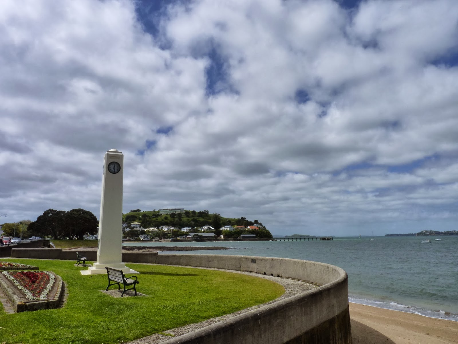
I took the ferry back to the mainland, stopping en route to visit Devonport, a residential area seperated from the main city. Its a quiet area with a small town feel and lots of pretty Victorian and Edwardian properites, which I viewed on a walking tour, for which I picked up a map and guide from the local i-site.
Back
on the mainland I treated myself to a gelato and headed to the
Voyager Maritime Museum. Their displays trace NZ's maritime history
from Maori beginnings to the modern day. Of all the many displays at
the museum, I found the information on the first European
explorations of New Zealand the most interesting. The first of these
was by Abel Tasman, a Dutchman who in 1642 came upon 'a land uplifted
high'; the Southern Alps of the South Island. Tasman sailed north
up the coast and around Cape Farewell and anchored in a bay. After a
disastrous encounter with the Maori, which resulted in deaths on both
sides, Tasman named the area Murderers Bay (now called Golden Bay)
and headed north again, skirting the North Island. He charted some
of the country but failed to discover that this new land was a
separate country and not part of South America. Tasman then
abandoned New Zealand and went on to chart some of Polynesia and
Fiji.
In
1769 two more European ships sighted New Zealand's shores, but had
differing success. A French ship captained by Jean Francois Marie de
Surville battled rough seas and suffered heavy crew losses through
scurvy, before landing in Doubtless Bay. After some less than
friendly interactions with the Maori Surville sailed east and lost
his life trying to land on Peru's coast. Meanwhile Captain James
Cook, captain of the Endeavour, sighted the east coast of New
Zealand. His voyage had been gifted with more luck than de Surville,
with his crew in much better shape thanks to Cook ensuring his crew
take regular exercise on the ship's deck, and supplying the crew with
limes to avoid scurvy (which is why we British are called Limeys!).
After landing at poverty bay and meeting a defensive, angry
population of Maori, Cook tried landing again further south and, with
the help of a Tahitian chief he had on board, met and conversed with
a more accommodating group of Maori. Cook went on to successfully
chart New Zealand's coastline and study extensively the flora and
fauna of the country and of the Maori inhabitants, who Cook described
as 'powerful, aggressive and brave'. Cook's further two voyages
allowed him to further study the Maori, writing in his journals that
the Maori are 'manly and mild' in their dealings with him, and 'they
have some arts among them which they execute with great judgement and
unwearied patience'.
On
the upper floors of the Maritime Museum were displays on the
America's Cup. I smiled in irony at the small cinema room offering
videos of 'The America's Cup 2013 Highlights' – there was no video
playing. I wonder if there are some less than happy feelings still
about New Zealand's defeat...
Am already booking my tour of the Maritime Museum, especially on the lookout for those special yachts :-)
ReplyDeletexx
What a lovely day exploring you had! Fabulous pictures - feels like a world away from our drizzly and cold autumn days. Ax
ReplyDelete